
In the realm of space exploration and Earth observation, NASA continues to push the boundaries of technology with innovative missions aimed at creating detailed 3D maps of our planet and beyond. From the groundbreaking Shuttle Radar Topography Mission (SRTM) in 2000 to the proposed Earth Dynamics Geodetic Explorer (EDGE) and the Multi-Resolution Scanner (MRS) currently being tested on the International Space Station (ISS), these initiatives are transforming our understanding of Earth’s surface and paving the way for future space exploration.
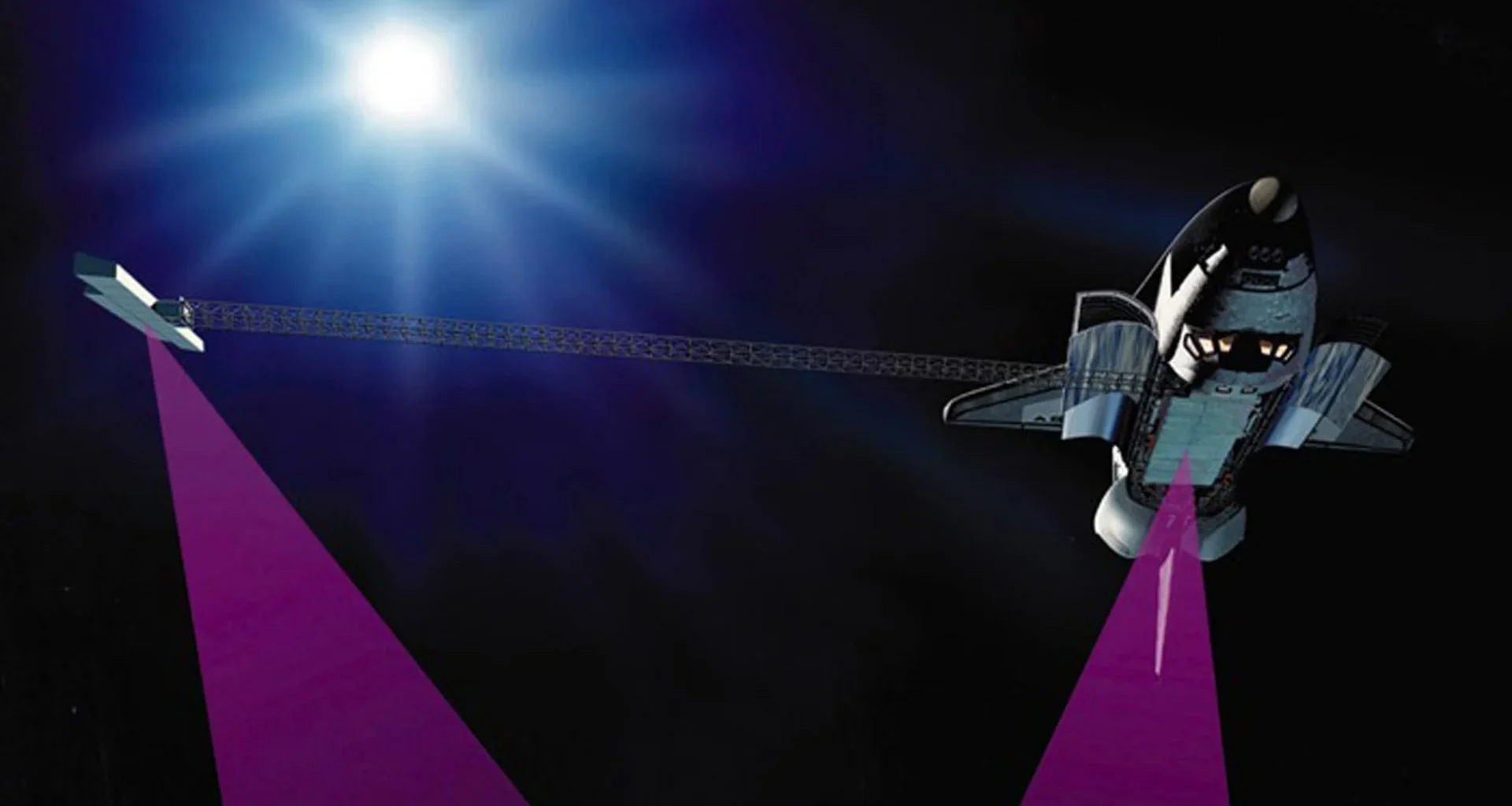
The SRTM, launched aboard the Space Shuttle Endeavour in February 2000, marked a significant milestone in global mapping. Led by Commander Kevin Kregel, the mission utilized a 200-foot-long mast equipped with radar antennas to create an unprecedented 3D map of Earth’s topography. Despite technical challenges, including a frozen gas jet system, the crew’s innovative “fly-cast” maneuver allowed them to successfully map over 80% of Earth’s landmass. This data continues to be invaluable for various applications, from wildfire forecasting to flood risk assessment and wind turbine placement.
Building on SRTM’s success, NASA is now considering the EDGE mission as part of its Earth System Explorers Program. EDGE aims to provide even more detailed 3D mapping of global vegetation and ice structures. Led by UC San Diego’s Helen Fricker and involving a team of 25 scientists and engineers, including Northern Arizona University’s Chris Hakkenberg, EDGE would use advanced space-borne lidar technology to capture high-resolution data on forest structure and ice sheet dynamics. This mission could prove crucial for monitoring carbon storage, biodiversity, and climate change impacts on a global scale.
While EDGE is still in the concept phase, another cutting-edge 3D mapping technology is already being tested on the ISS. The Multi-Resolution Scanner (MRS), a collaboration between Boeing and Australia’s CSIRO, is utilizing NASA’s Astrobee robotic system to create detailed 3D maps of the space station’s interior. This technology combines multiple sensors and advanced software, including CSIRO’s Stereo-Depth Fusion and Wildcat 3D SLAM (Simultaneous Localization and Mapping) algorithms, to generate highly accurate environmental maps while tracking the robot’s movement.
The potential applications of MRS extend far beyond the ISS. This technology could be instrumental in mapping unexplored terrains on the Moon or Mars, enabling autonomous navigation for future robotic explorers. It could also play a crucial role in maintaining and monitoring future space stations or outposts that may not be continuously crewed by humans, such as NASA’s planned lunar Gateway.
These mapping technologies are not only advancing space exploration but also finding applications on Earth. The data from SRTM has been used in tens of thousands of research papers across various fields, while MRS technology could benefit industries such as mining and disaster relief by providing detailed, real-time mapping of complex environments.
The evolution of these 3D mapping technologies showcases the rapid advancements in space-based Earth observation and exploration capabilities. From the SRTM’s initial global topographic survey to EDGE’s potential for tracking minute changes in vegetation and ice, and MRS’s ability to create detailed maps of enclosed spaces, each iteration builds upon previous successes to provide more accurate, comprehensive, and actionable data.
As we look to the future of space exploration and Earth observation, these technologies will play a crucial role in our understanding of our planet and our ability to navigate and study other worlds. They represent not just technological achievements but also the power of international collaboration and the potential for space research to benefit life on Earth.
With ongoing developments and upcoming missions, the future of 3D mapping in space looks promising. These technologies will continue to evolve, providing scientists, policymakers, and industries with invaluable data to address global challenges, from climate change to resource management, while simultaneously enabling the next giant leaps in space exploration.